|
|
|
 |
|
| Geophysical Services |
| Page: 3/3 | |
 |
|
|
Airborne Geophysics
NOSSB is proud to be associated with McPhar
International, a leading international airborne geophysical
surveys contractor.
The services McPhar provide involved the acquisition of
gravity and gravity gradient data, magnetic and magnetic
gradient data, and oil seep data from a fleet of fixed-wing
aircraft based in the UK, South Africa and Singapore
The data acquired from such surveys are processed,
mapped, imaged and interpreted at our data processing
centers in India and/or South Africa.
Quality Control: The quality assurance program at McPhar
International is designed to ensure that every survey is
planned and executed to obtain final products of the
highest quality possible. McPhar incorporates important
control procedures into all parts of the survey process. |
 |
Data Processing: Final Data Processing is undertaken at
McPhar International’s Data Processing Centers in India
and/or South Africa. Final Products include color images
on paper and digital data on CD-ROM/DVD and a Final
Report.
Interpretation: Many techniques are available to apply to
an interpretation project;
- to determine depths to causative sources
- to delineate discontinuities and boundaries
- and to draw conclusions regarding geological structure
beneath the survey
A variety of proprietary in-house and commercial software
is utilized for this work. |
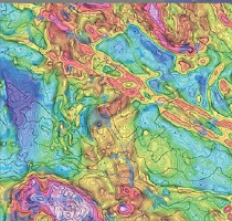
Aeromagnetics:
An airborne magnetic system utilizes one or more
high-sensitivity magnetometers installed on a fixed-wing
aircraft or helicopter, to measure changes in the earth’s
magnetic feld. The data is extremely useful in mapping
the tectonics (faults, structures, lineaments in the ground).
|
 |
Seepfinder:
Mounted in a light aircraft, and steered by satellite GPS
navigation, SEEPFINDER records the presence of thin
molecular oil films on the surface of the sea.
Gravity:
An airborne gravity sensing system providing
high-resolution gravity data ONLY. Used almost exclusively
in Oil & Gas exploration to map sedimentary basins and to
provide information on structure and depth.
McPhar has undertaken well over five million line-km of
airborne geophysical surveys worldwide using both
fixed-wing aircraft and helicopters, for a variety of clients,
including mining companies, oil/gas companies and
government agencies.
|
|
|
|
|
|
|